NASA scientists have released the clearest, composite view yet of Earth after dark.
The first global map of the planet at night was produced by the National Oceanic and Atmospheric Administration and NASA in 2012. Researchers have created an updated version with images captured four years later.
The new collection of satellite photos have been enhanced via high-res software augmented by population and energy data. A team from NASA’s Earth Observing Satellite Data and Information System spent months piecing the imagery together from the best of moonlight-free photos on the clearest nights each month.
Armed with cutting-edge nighttime photography equipment, scientists have automated processing satellite imagery to provide the clearest view possible just hours after they are taken, according to NASA. The photos, NASA says, have the potential to improve disaster response and short-term weather forecasting.
Plus they look stunning.
The technology will soon allow photos like this to be produced on a daily basis as early as later this year.
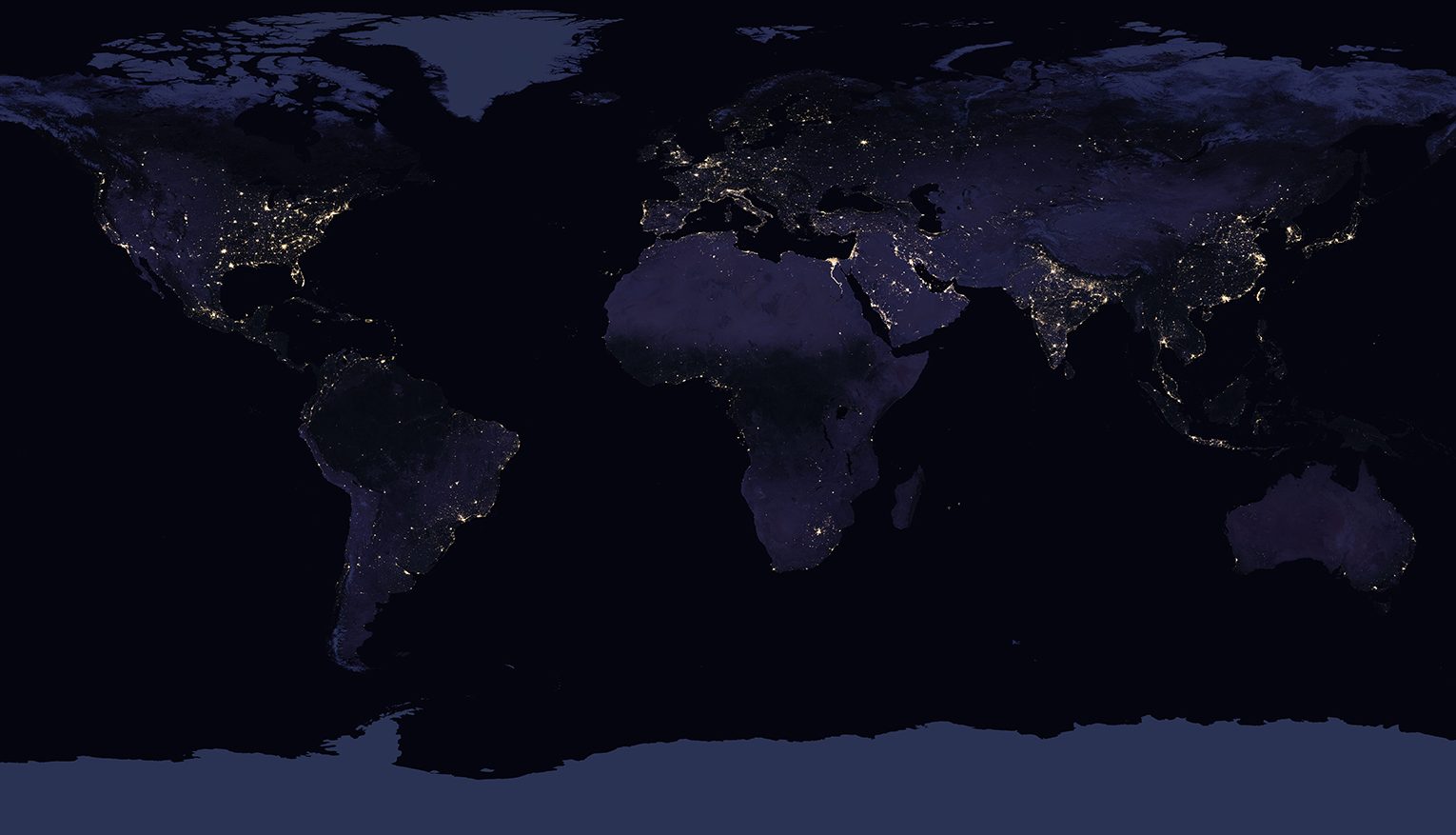
NASA scientists have just released the first new global map of Earth at night since 2012. (NASA Earth Observatory images by Joshua Stevens, using Suomi NPP VIIRS data from Miguel Román, NASA’s Goddard Space Flight Center)

Composite image created in 2016 of continental U.S. at night. (NASA Earth Observatory images by Joshua Stevens, using Suomi NPP VIIRS data from Miguel Román, NASA’s Goddard Space Flight Center)

Composite image of Europe at night, 2016. (NASA Earth Observatory images by Joshua Stevens, using Suomi NPP VIIRS data from Miguel Román, NASA’s Goddard Space Flight Center)
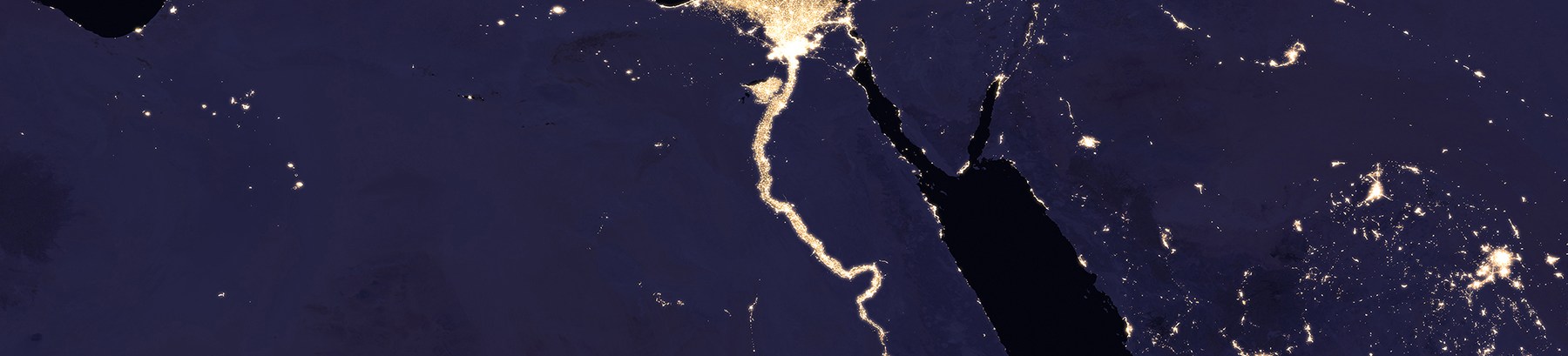
Composite image of Nile River and surrounding region at night, 2016. (NASA Earth Observatory images by Joshua Stevens, using Suomi NPP VIIRS data from Miguel Román, NASA’s Goddard Space Flight Center)
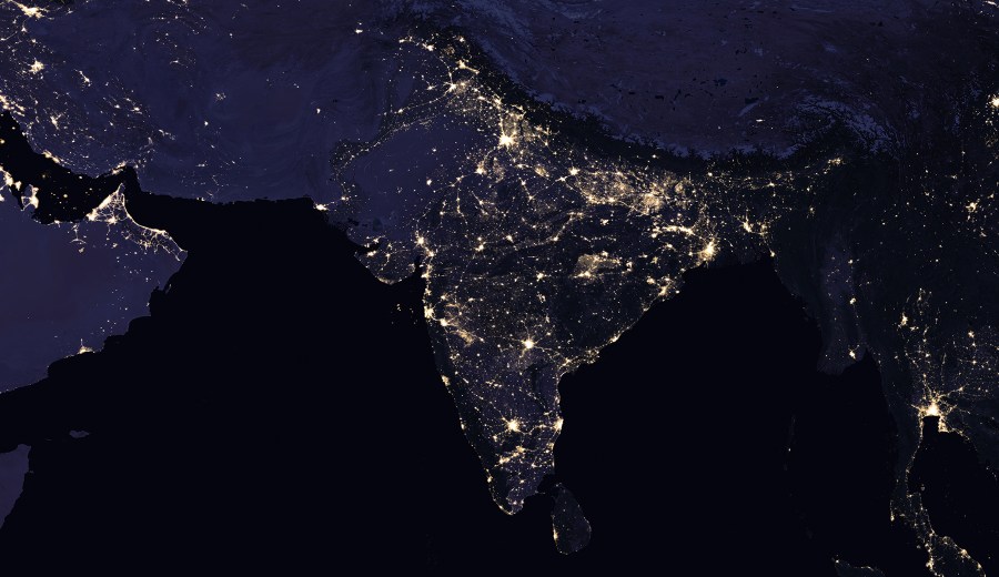
A composite nighttime view of India and surrounding areas. (NASA Earth Observatory images by Joshua Stevens, using Suomi NPP VIIRS data from Miguel Román, NASA’s Goddard Space Flight Center)

This composite image provides a full-hemisphere view of Earth at night and shows Europe, North Africa, and the Middle East. (NASA Earth Observatory images by Joshua Stevens, using Suomi NPP VIIRS data from Miguel Román, NASA’s Goddard Space Flight Center)

Satellite photo of the Mediterranean region at night, 2016. (NASA Earth Observatory images by Joshua Stevens, using Suomi NPP VIIRS data from Miguel Román, NASA’s Goddard Space Flight Center)
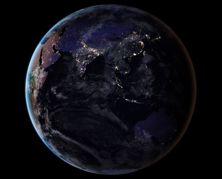
This composite image provides a full-hemisphere view of Earth at night, showing East Asia and the Pacific. (NASA Earth Observatory images by Joshua Stevens, using Suomi NPP VIIRS data from Miguel Román, NASA’s Goddard Space Flight Center)
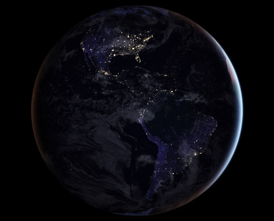
This composite image provides a full-hemisphere view of Earth at night, showing North and South America. (NASA Earth Observatory images by Joshua Stevens, using Suomi NPP VIIRS data from Miguel Román, NASA’s Goddard Space Flight Center)

This composite image provides a full-hemisphere view of Earth at night and showing Africa. (NASA Earth Observatory images by Joshua Stevens, using Suomi NPP VIIRS data from Miguel Román, NASA’s Goddard Space Flight Center)

Composite image of East Asia at night, 2016. (NASA Earth Observatory images by Joshua Stevens, using Suomi NPP VIIRS data from Miguel Román, NASA’s Goddard Space Flight Center)
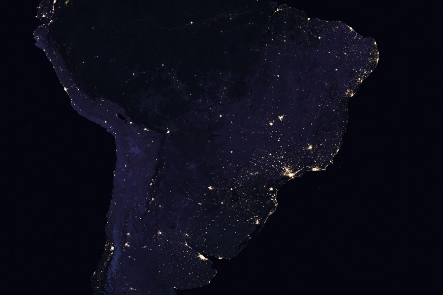
Composite image of South America at night, 2016. (NASA Earth Observatory images by Joshua Stevens, using Suomi NPP VIIRS data from Miguel Román, NASA’s Goddard Space Flight Center)
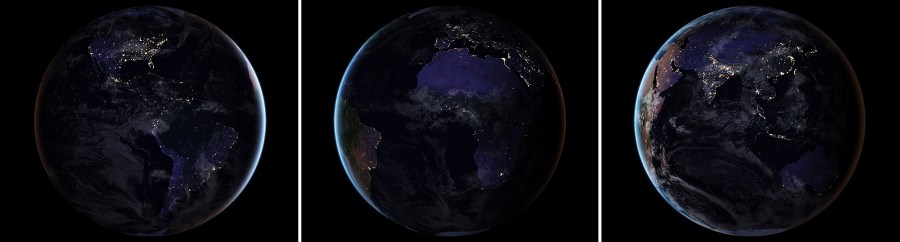
These three composite images provide full-hemisphere views of Earth at night. The clouds and sun glint — added here for aesthetic effect — are derived from MODIS instrument land surface and cloud cover products. (NASA Earth Observatory images by Joshua Stevens, using Suomi NPP VIIRS data from Miguel Román, NASA’s Goddard Space Flight Center)
This article was featured in the InsideHook newsletter. Sign up now.