For the past 20 years, Mars has been crawling with robots.
NASA landed the first rover on Mars, the Pathfinder, on July 4, 1997. That achievement heralded the beginning of a legacy that was continued by the now defunct Spirit, and later the active Curiosity and Opportunity rovers.
The Pathfinder was launched in 1996 and became the first robotic spacecraft to land on another surface beyond the Moon, according to NASA. Though a seven-day mission was planned, the rover continued its mission for a total of 83 days.
Together, the NASA rovers have produced a treasure trove of scientific data, but also terabytes of images from Mars. A product of talented engineering, the robots provide a glimpse of the planet humans hope to colonize in the future.
These images provide evidence of the potential for that future.
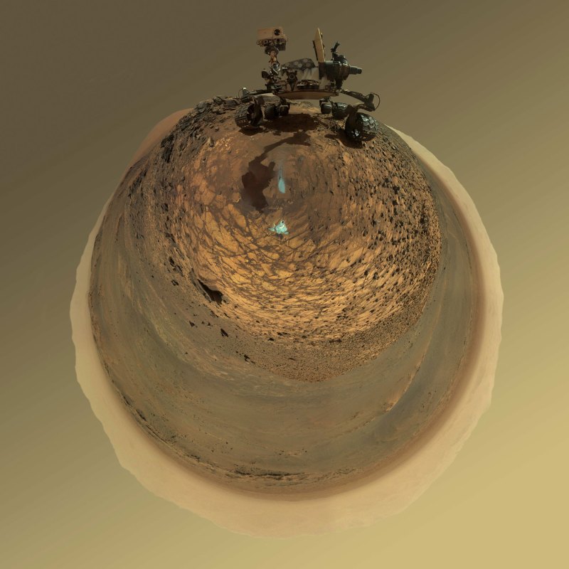
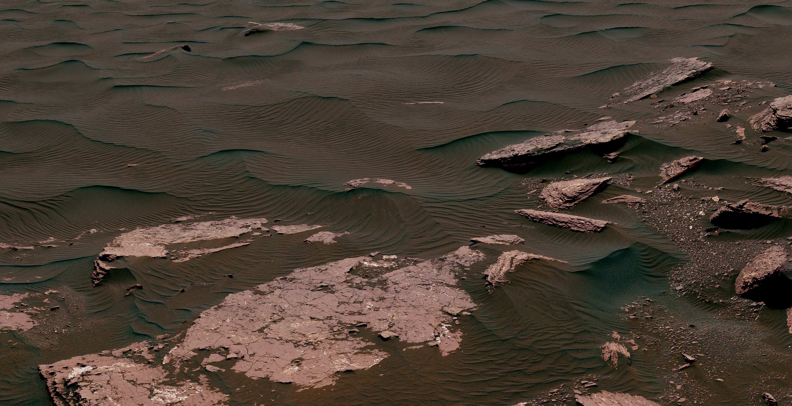
This 360-degree mosaic from the Mast Camera (Mastcam) on NASA’s Curiosity Mars rover looks out over a portion of the Bagnold Dunes, which stretch for several miles. (NASA)
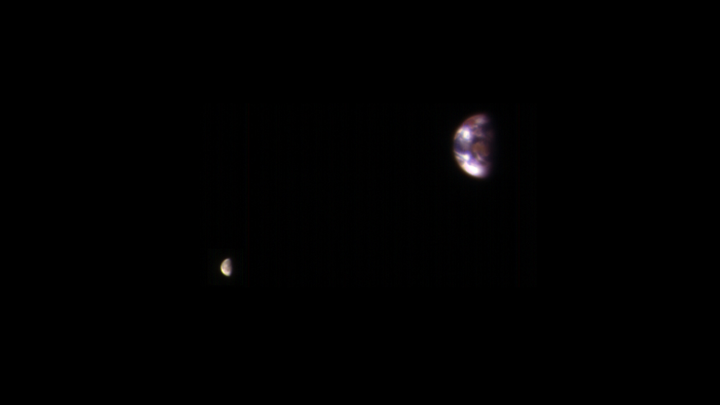
Here is a view of Earth and its moon, as seen from Mars. It combines two images acquired on Nov. 20, 2016, by the HiRISE camera on NASA’s Mars Reconnaissance Orbiter, with brightness adjusted separately for Earth and the moon to show details on both bodies. (NASA)
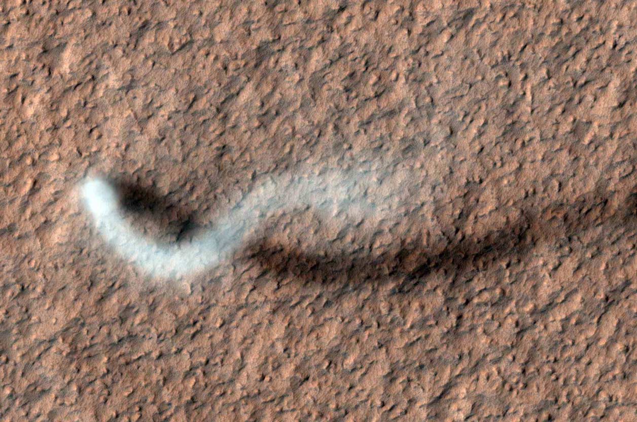
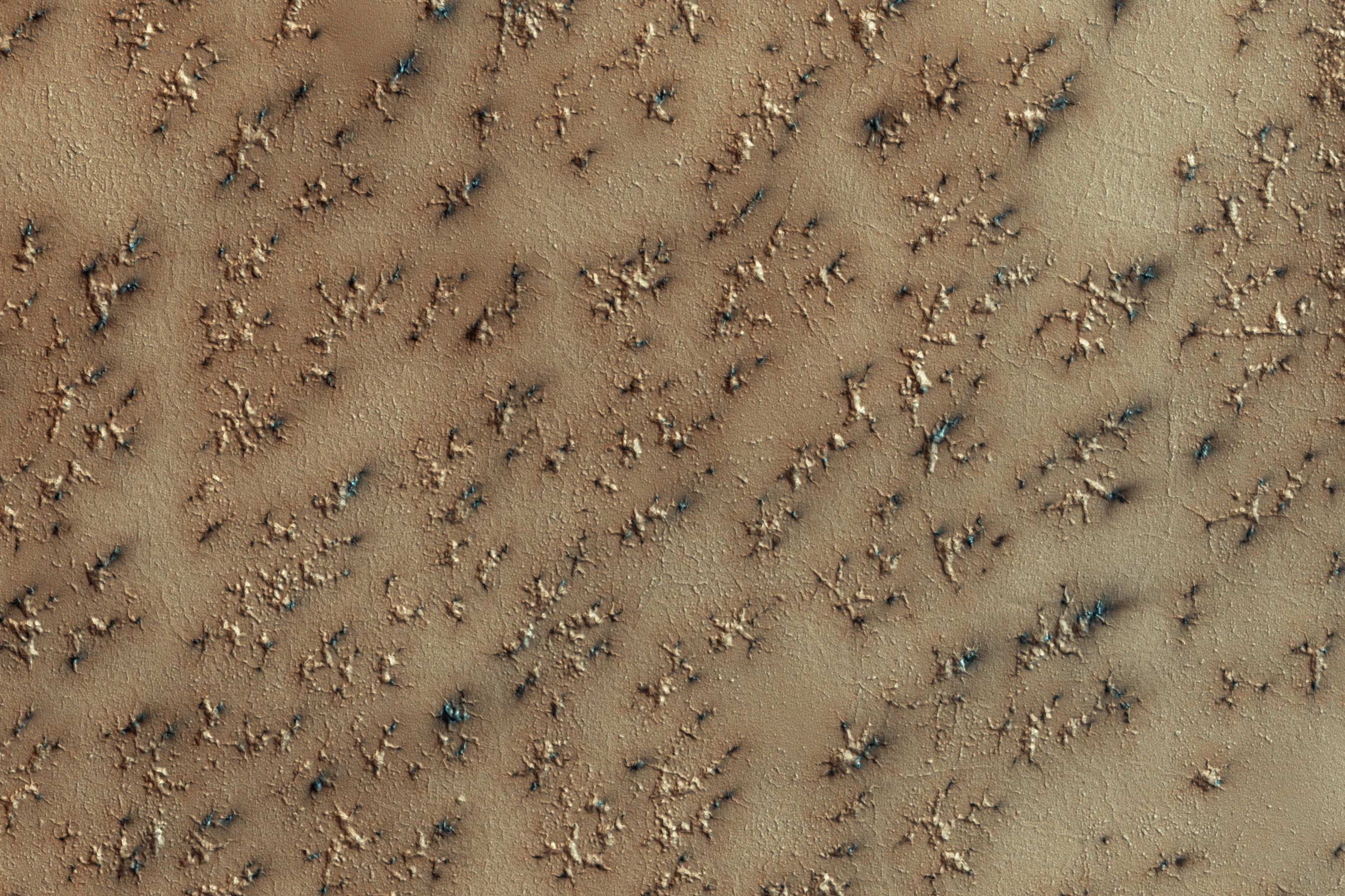
A towering dust devil casts a serpentine shadow over the Martian surface in this image acquired by the High Resolution Imaging Science Experiment (HiRISE) camera on NASA’s Mars Reconnaissance Orbiter. (NASA)
The rippled surface of the first Martian sand dune ever studied up close fills this view of “High Dune” from the Mast Camera (Mastcam) on NASA’s Curiosity rover. (NASA)
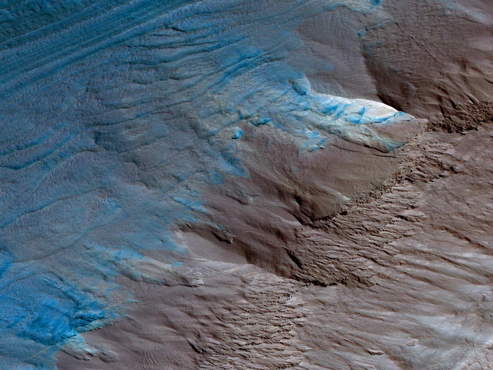
This image, an oblique view from NASA’s Mars Reconnaissance Orbiter of the sloping edge of the stack of icy layers over the South Pole, has some interesting morphologies. (NASA)
This evenly layered rock imaged in 2014 by the Mastcam on NASA’s Curiosity Mars rover shows a pattern typical of a lake-floor sedimentary deposit near where flowing water entered a lake. Shallow and deep parts of an ancient Martian lake left different clues in mudstone formed from lakebed deposits. (NASA/JPL-Caltech/MSSS)
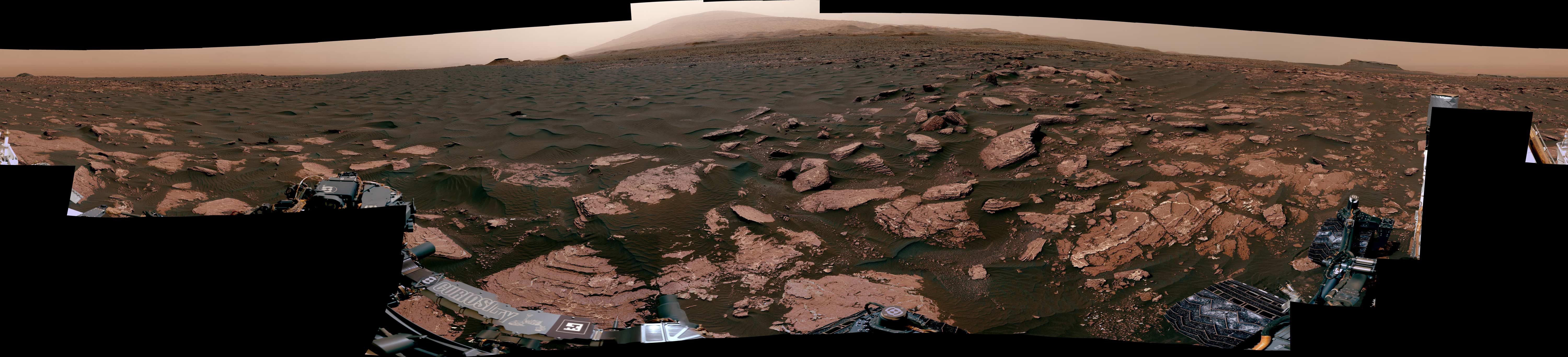
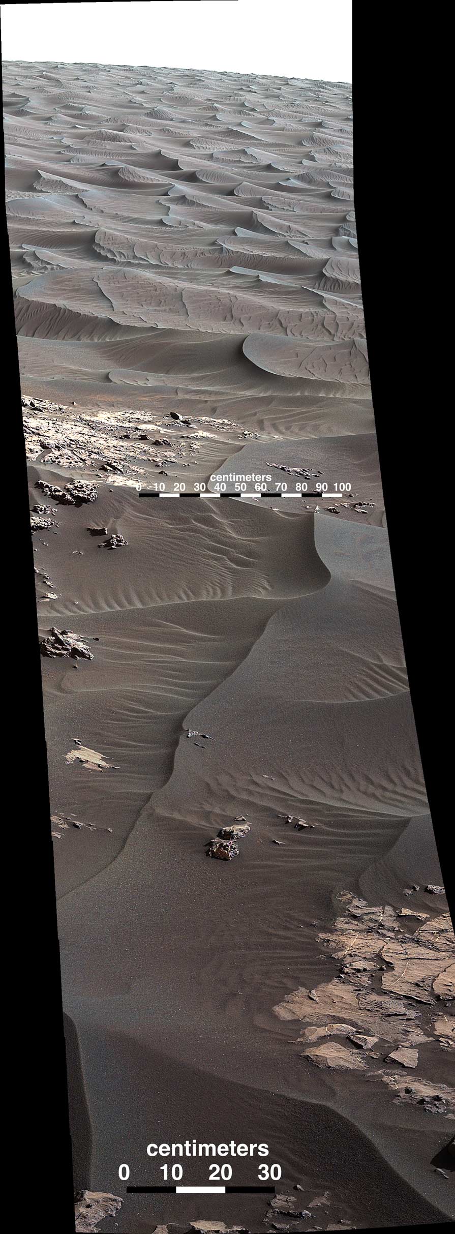
This view from the Mast Camera (Mastcam) on NASA’s Curiosity Mars rover shows two scales of ripples, plus other textures, in an area where the mission examined a linear-shaped dune in the Bagnold dune field on lower Mount Sharp in March and April 2017.
(NASA/JPL-Caltech/MSSS)
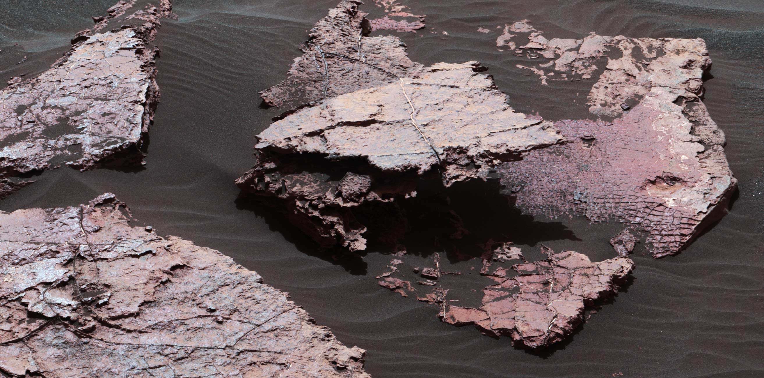
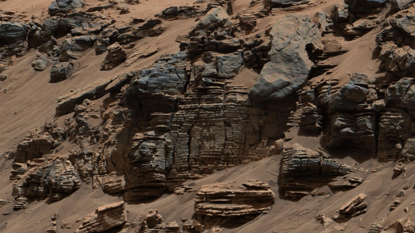
A grid of small polygons on the Martian rock surface near the right edge of this view may have originated as cracks in drying mud more than 3 billion years ago. Multiple Dec. 20, 2016, images from the Mastcam on NASA’s Curiosity Mars rover were combined for this view of a rock called “Squid Cove.”
(NASA/JPL-Caltech/MSSS)
A layer of dry ice covers the South Polar layered deposits every winter. (NASA)
This article was featured in the InsideHook newsletter. Sign up now.