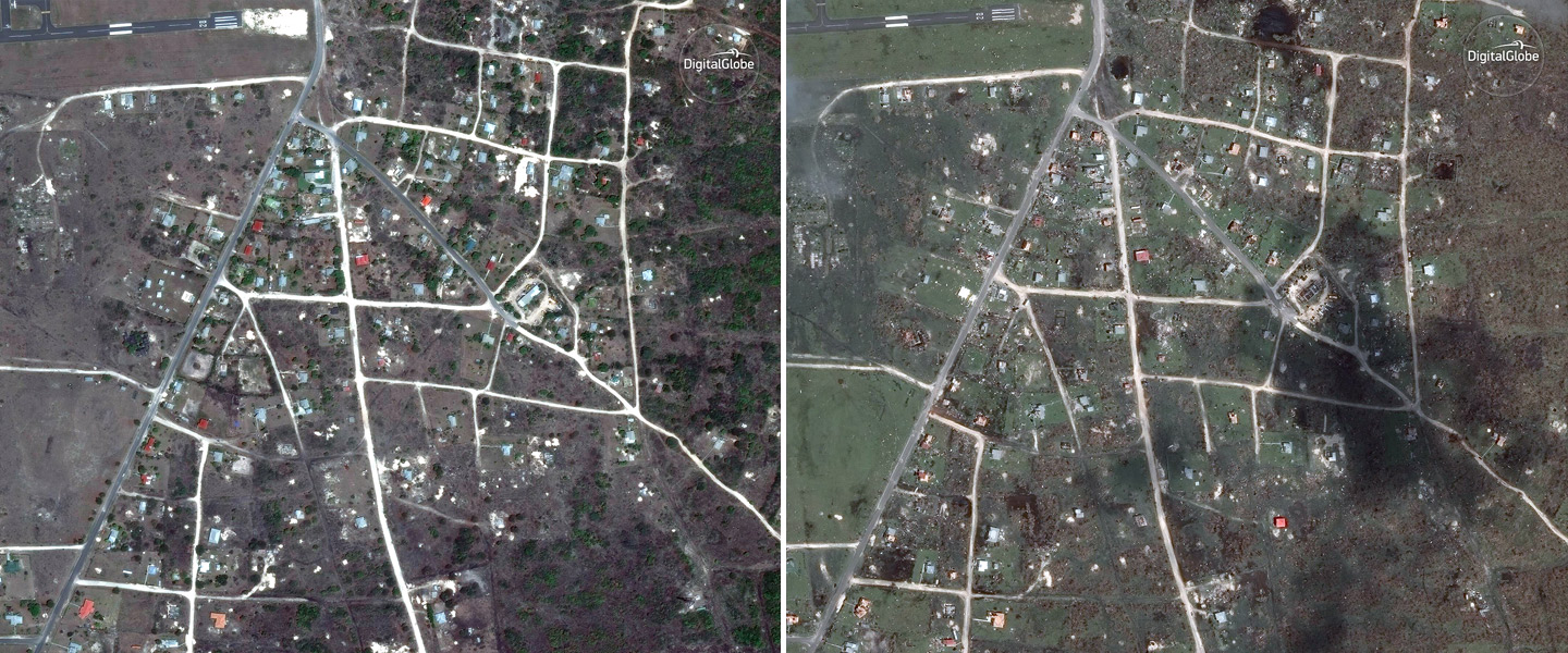
Hurricane Irma weakened to a tropical storm on Monday evening, but not before it left a path of damage through the Caribbean and parts of Florida.
DigitalGlobe’s satellites have captured high-resolution before-and-after images taken between Friday, Sept.8, and Monday, Sept. 11. The photos show several locations in the Carribean that include Tortola, Turks and Caiscos, Sint Maarten, Necker Island, Barbuda and Saint Martin.
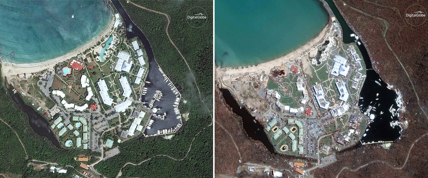
Anse Marcel, Saint Martin (L) Aug 25,2016, (R) Sept. 11 2017 (satellite image ©2017 DigitalGlobe)
Codrington, Barbuda (L) April 24,2014, (R) Sept 8 2017 (satellite image ©2017 DigitalGlobe)
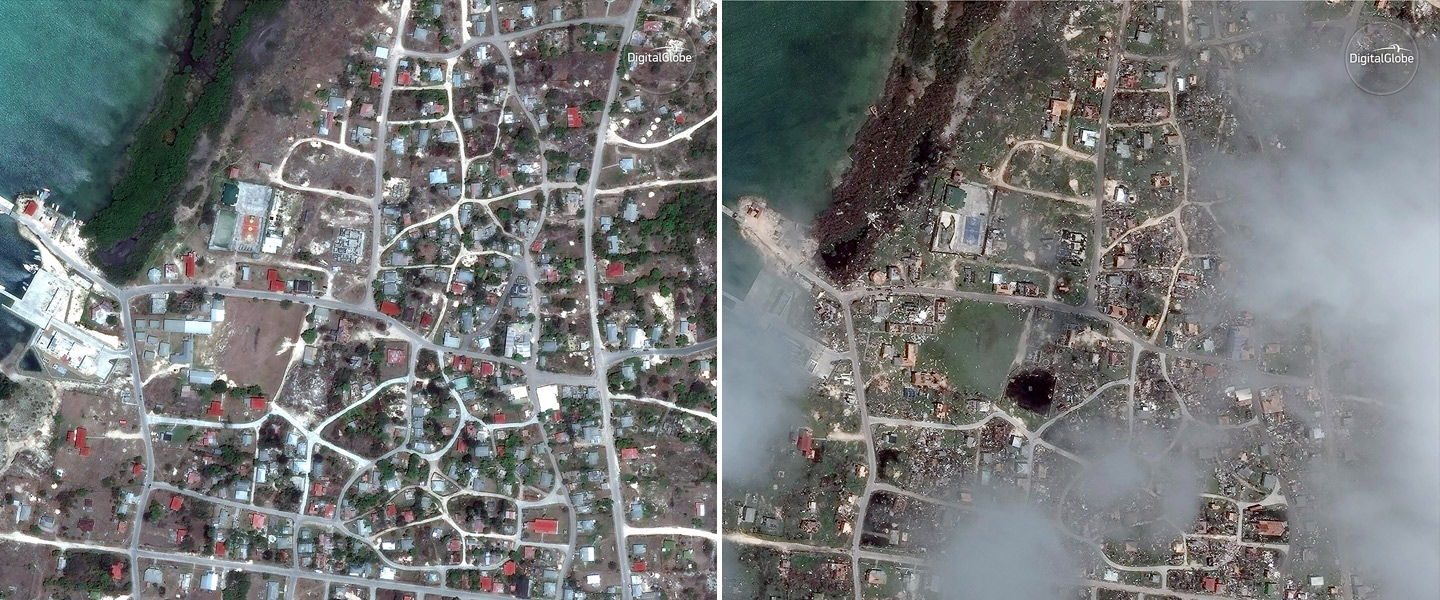
Port Barbuda in Codrington,Barbuda (L) April 24, 2014, (R) Sept 8, 2017 (satellite image ©2017 DigitalGlobe)
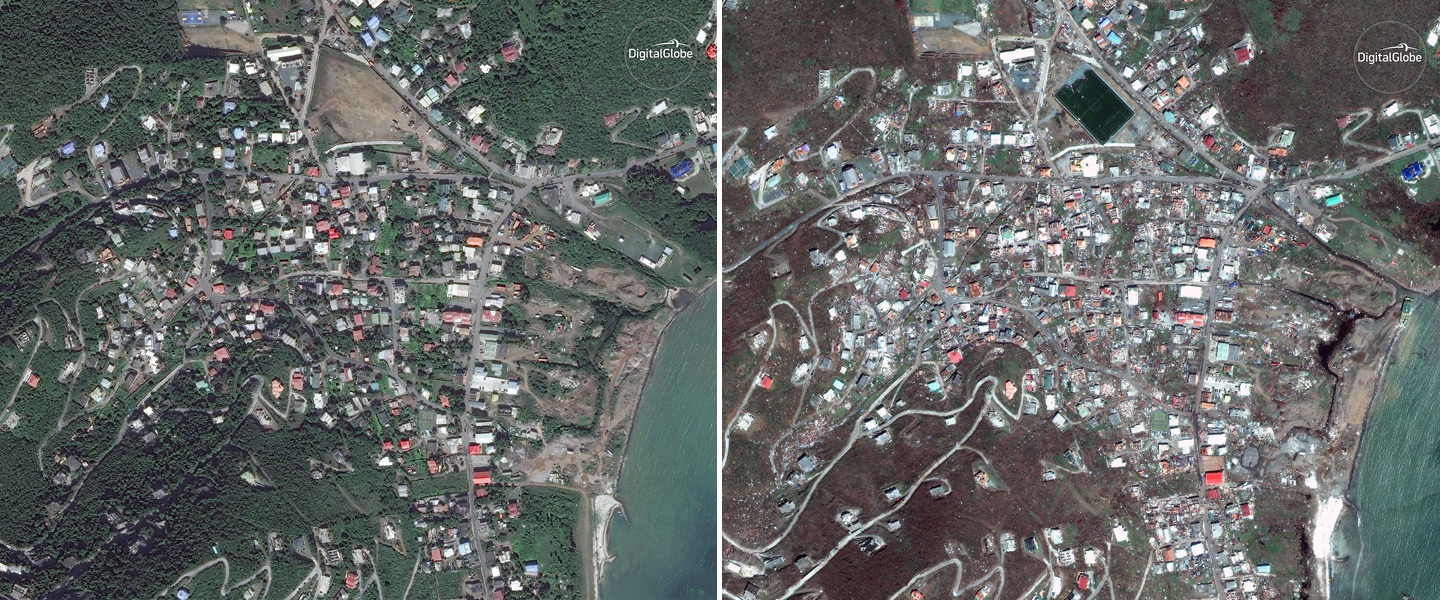
Parham Town, Tortola (L) Nov 25, 2016, (R) Sept 9,2017 (satellite image ©2017 DigitalGlobe)
Philipsburg Sint Maarten (L) Aug 25 2016, (R) Sept 11,2017 (satellite image ©2017 DigitalGlobe)
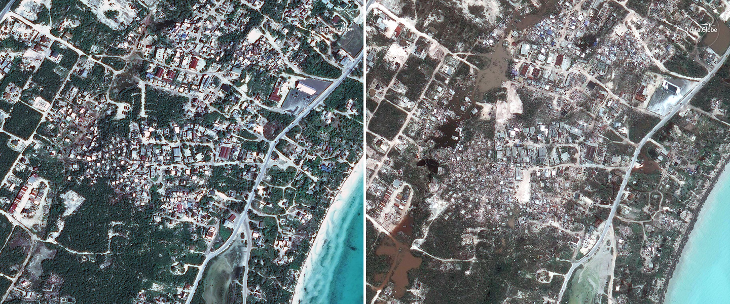
Providenciales, Turks and Caicos (L) Jan 1 2016, (R) Sept. 10, 2017 (satellite image ©2017 DigitalGlobe)
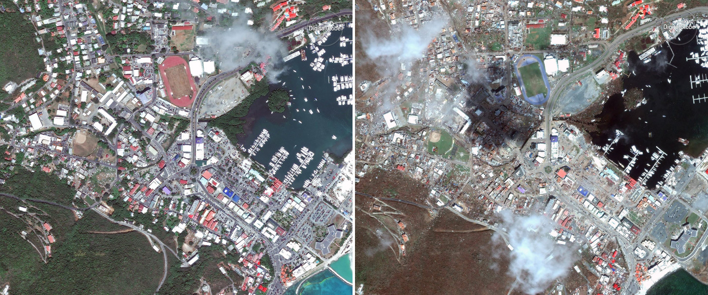
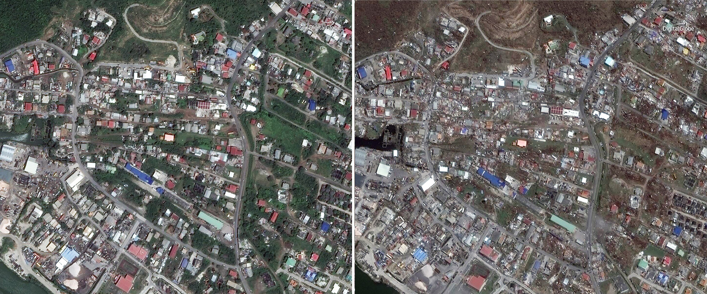
Road Town, Tortola (L) Mar.31, 2015, (R) Sept. 9, 2017 (satellite image ©2017 DigitalGlobe)
This article was featured in the InsideHook newsletter. Sign up now.