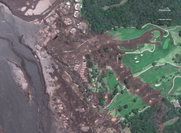
Satellite photos from the imagery company Digital Globe show parts of Guatemala blanketed by lava and ash after the country’s Volcan de Fuego, Spanish for “volcano of fire,” erupted and killed at least 99 people, Time reports.
The photos reveal before and after pictures of the world-famous La Reunion Golf Resort, which is now covered almost entirely with volcanic soot. The village of San Miguel Los Lotes was also destroyed and buried in the debris.
“You can actually see gases emanating from the cooling warm mass,” Stanley Mertzman, a volcanologist at Franklin and Marshall College, told Mashable over email.
Take a look at the pictures below.
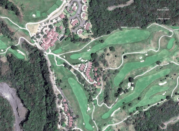
Hotel La Reunión Golf Resort and Residences before the eruption (IMAGE: ©2018 DIGITALGLOBE, A MAXAR COMPANY)
Hotel La Reunión Golf Resort and Residences after the eruption (IMAGE: ©2018 DIGITALGLOBE, A MAXAR COMPANY)
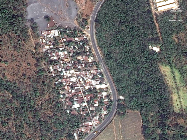
San Miguel Los Lotes before the eruption (IMAGE: ©2018 DIGITALGLOBE, A MAXAR COMPANY)
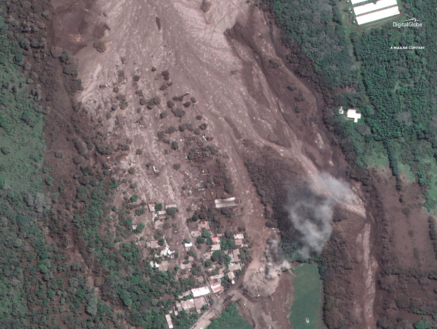
San Miguel Los Lotes after the eruption (IMAGE: ©2018 DIGITALGLOBE, A MAXAR COMPANY)
Thanks for reading InsideHook. Sign up for our daily newsletter and be in the know.